Tenured Professor at
The Open University of Japan
PROJECT II
mdbUA (meshed data based Urban Area) 2010 Japan
| Applying mdbUA on a national scale |
The “mdbUA2010 Japan” map was developed by screening each grid square with a population of ≥5,000 people per km2 following the application of the two criteria. Population densities of urban areas around the Pacific coastal belts were nearly equivalent to the conventional range of population concentration areas or densely inhabited districts (DID). However, many of the smaller cities had densities that were considerably smaller than the range defined by DID, and population differences between areas with densities of 4,000 vs. 5,000 people per km2 are reflected in the varying results. Similarly, applying the rule of a minimum of four linked meshes, many cities were not recognized as urban areas. Thus, a number of meshes with population densities of 4,000–4,999 people per km2 in some non-metropolitan areas were excluded as urban areas under our criteria. Nonetheless, we still identified over 100 urban areas, which is a sufficient number to begin construing urban dynamics in centers across the country.
The map below depicts individual local cities comprising a total number of 118 identified urban areas.
Map of “mdbUA2010 Japan”
※click on the map to open an enlarged version
Enlarged regionally, we now see that:.
In the Hokkaido area, Ebetsu has now been elevated to urban status, and
Asahikawa, Kushiro, Tomakomai, Otaru, Hakodate, and Sapporo are again identified
as urban areas.
In Aomori Prefecture, the same cities of Aomori, Hirosaki, and Hachinohe
are defined as urban areas.
The City of Akita in Akita Prefecture and Morioka
in Iwate Prefecture are again recognized as urban areas.
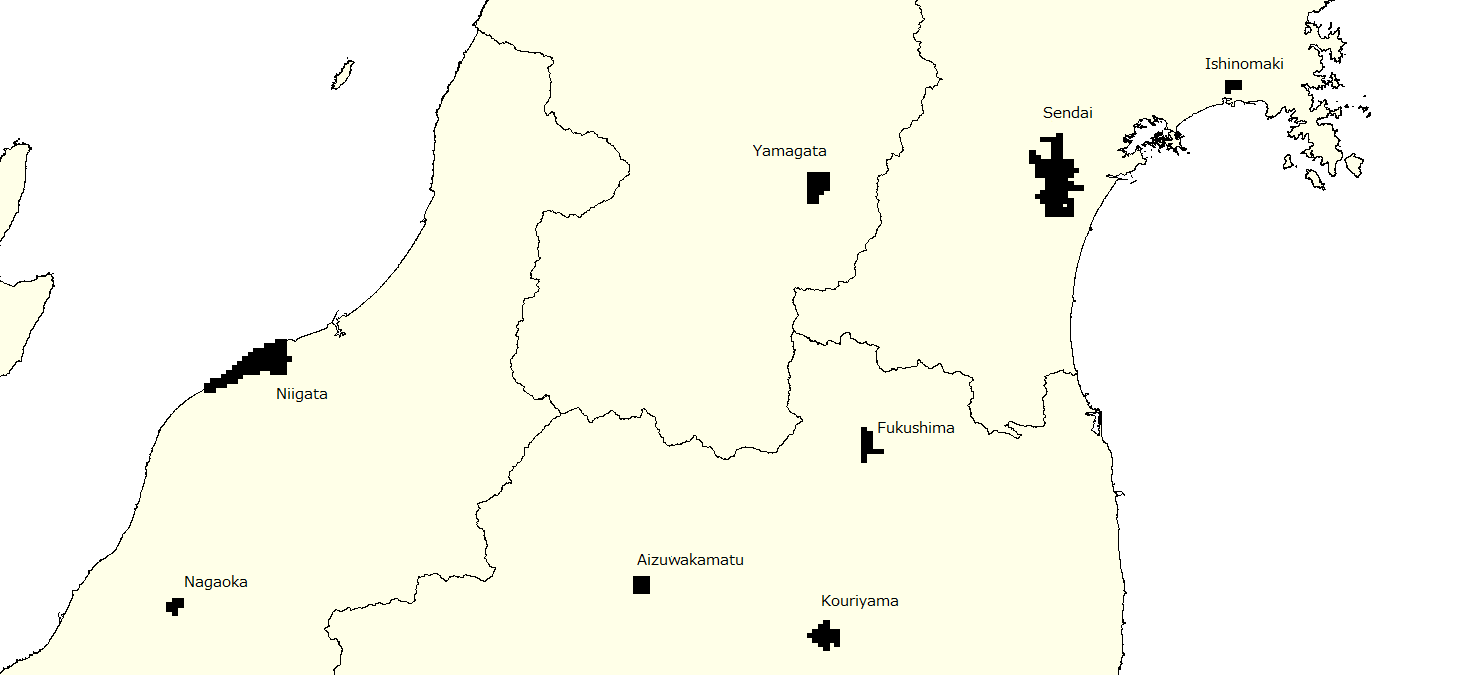
In Miyagi Prefecture, we see Sendai and Ishinomaki, and we can see the
city of Yamagata in Yamagata Prefecture. In addition, the cities of Fukushima,
Koriyama, and Aizuwakamatsu in Fukushima Prefecture and the cities of Niigata
and Nagaoka in Niigata Prefecture are all shown as urban areas.
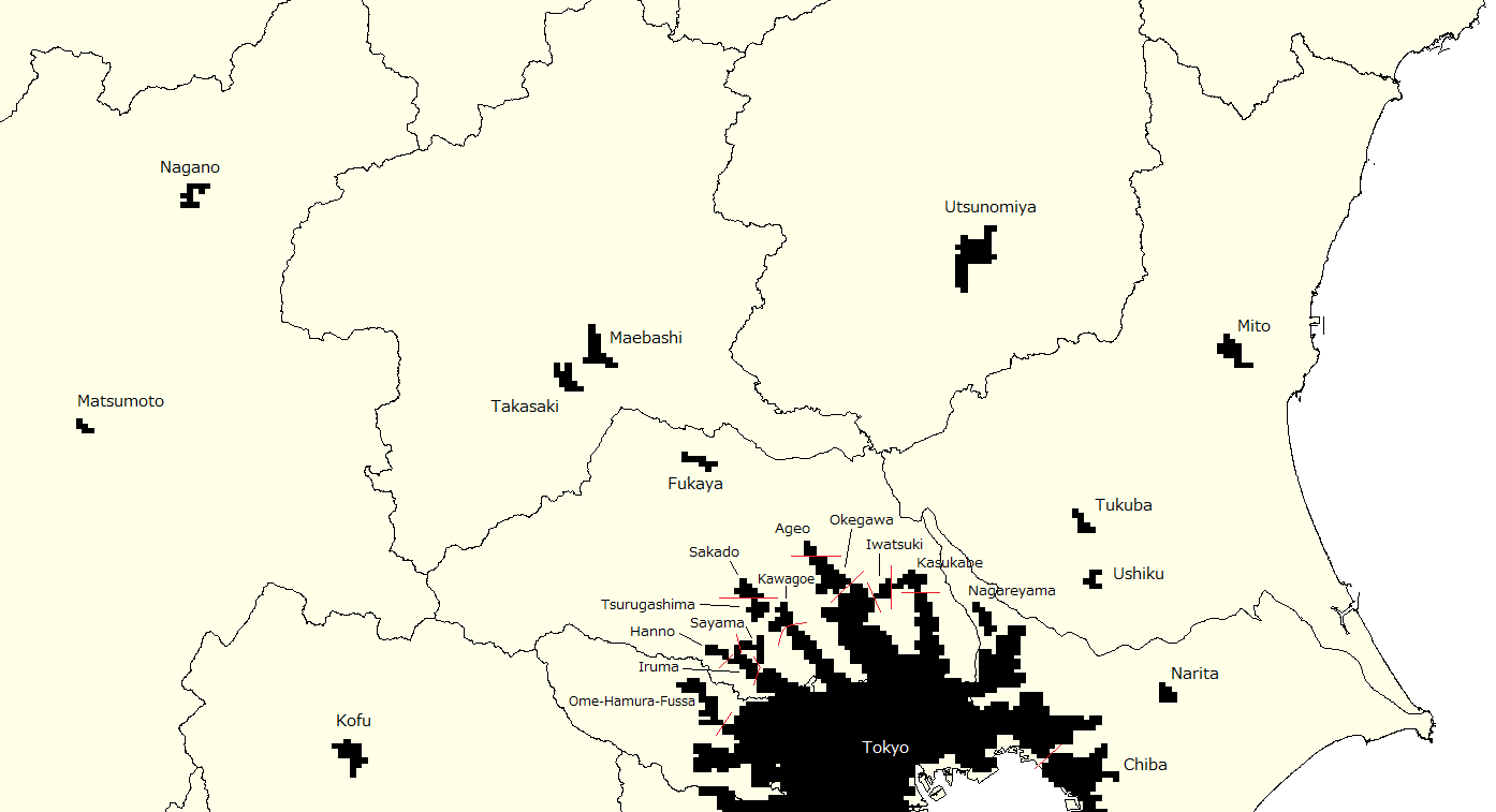
In the northern part of the Kanto area, we can
recognize Takasaki and Maebashi in Gunma Prefecture, Utsunomiya in Tochigi
Prefecture, and Mito, Tsukuba, and Ushiku in Ibaraki Prefecture. In Nagano
Prefecture, we can see Nagano and Matsumoto, and in Yamanashi Prefecture Kofu
is identifiable as an urban area.
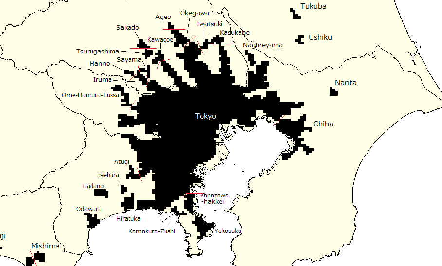 In the Kanto area, Tokyo’s urban area widely expands to include Yokohama
and Kawaseki, and many cities have been identified as urban areas, including
Ome, Hamura, and Fussa in Tokyo; Chiba, Narita, Nagareyama in Chiba Prefecture;
Kasukabe, Iwatsuki, Okegawa, Ageo, Kawagoe, Sakado, Tsurugashima, Sayama,
Hanno, and Iruma in Saitama Prefecture; and Atsugi, Isehara, Hadano, Odawara,
Hiratsuka, Kamakura / Zushi, Kanazawa-Hakkei, and Yokosuka in Kanagawa
Prefecture.
In the Kanto area, Tokyo’s urban area widely expands to include Yokohama
and Kawaseki, and many cities have been identified as urban areas, including
Ome, Hamura, and Fussa in Tokyo; Chiba, Narita, Nagareyama in Chiba Prefecture;
Kasukabe, Iwatsuki, Okegawa, Ageo, Kawagoe, Sakado, Tsurugashima, Sayama,
Hanno, and Iruma in Saitama Prefecture; and Atsugi, Isehara, Hadano, Odawara,
Hiratsuka, Kamakura / Zushi, Kanazawa-Hakkei, and Yokosuka in Kanagawa
Prefecture.
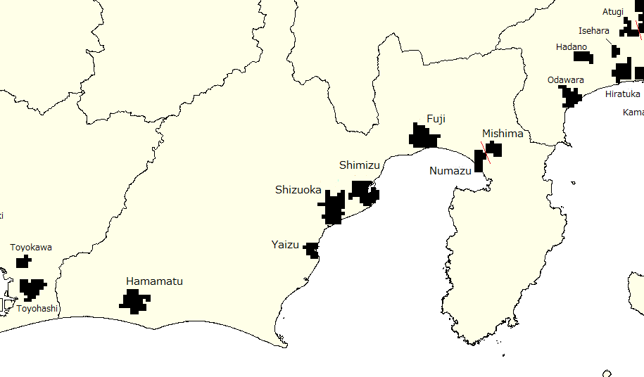
In Shizuoka Prefecture, Mishima, Numazu, Fuji,
Shimizu, Shizuoka, Yaizu, and Hamamatsu are defined as urban areas.
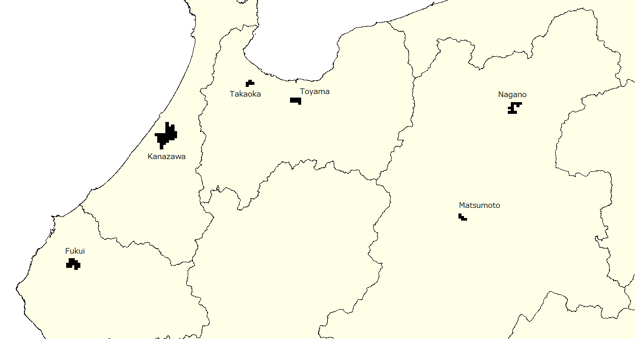
In the Hokuriku region, the same cities are identified as urban areas:
Toyama and Takaoka in Toyama Prefecture; Kanazawa in Ishikawa Prefecture;
and Fukui in Fukui Prefecture.
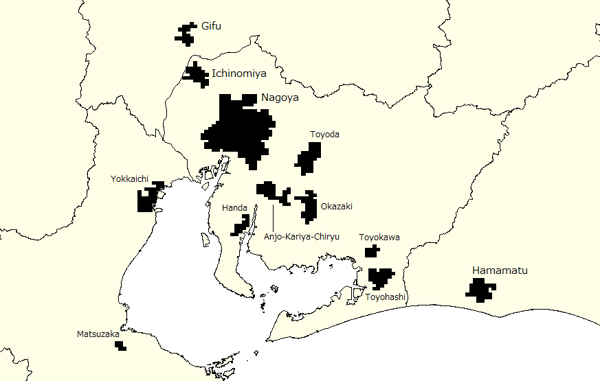
In Aichi Prefecture, Ichinomiya, Toyota, Handa, Anjo/Kariya/Chiryu, Okazaki,
Toyokawa, and Toyohashi were identified around Nagoya. Other urban areas
include Gifu in Gifu Prefecture and Yokkaichi and Matsusaka in Mie Prefecture.
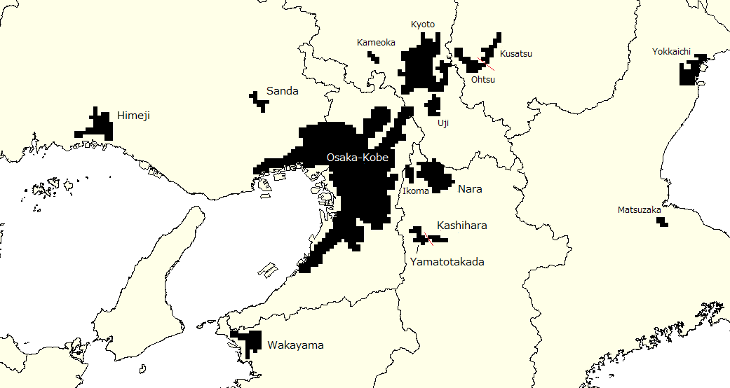 In the Kansai area, Osaka and Kobe are defined as a single metropolitan
area. Other urban areas include Kyoto, Kameoka, and Uji in Kyoto Prefecture;
Nara, Ikoma, Yamato, Takada, and Kashihara in Nara Prefecture; Kusatsu
and Otsu in Shiga Prefecture; and Wakayama in Wakayama Prefecture.
In the Kansai area, Osaka and Kobe are defined as a single metropolitan
area. Other urban areas include Kyoto, Kameoka, and Uji in Kyoto Prefecture;
Nara, Ikoma, Yamato, Takada, and Kashihara in Nara Prefecture; Kusatsu
and Otsu in Shiga Prefecture; and Wakayama in Wakayama Prefecture.
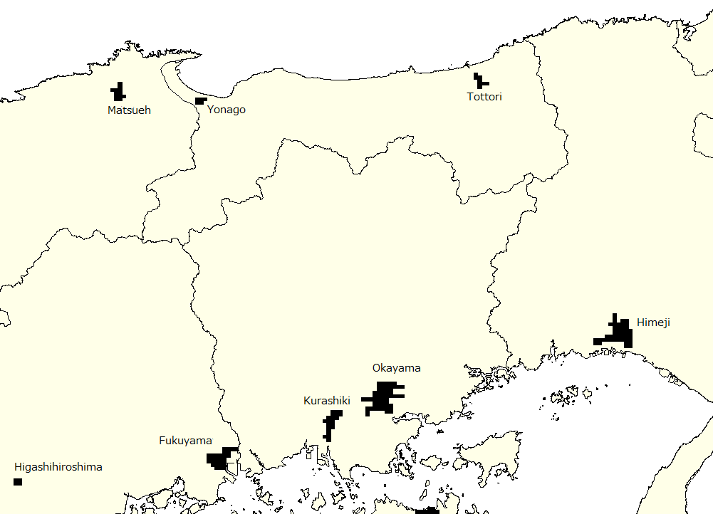
In the Chugoku area, the cities of Tottori and
Yonago in Tottori Prefecture are marked, along with Matsue in Shimane
Prefecture. Urban areas along the Seto Inland Sea coast comprise Sanda and
Himeji in Hyogo Prefecture, as well as Okayama and Kurashiki in Okayama
Prefecture.
![]()
The cities of Hiroshima, Fukuyama, Higashi-Hiroshima and Kure in Hiroshima
Prefecture are confirmed as urban areas..
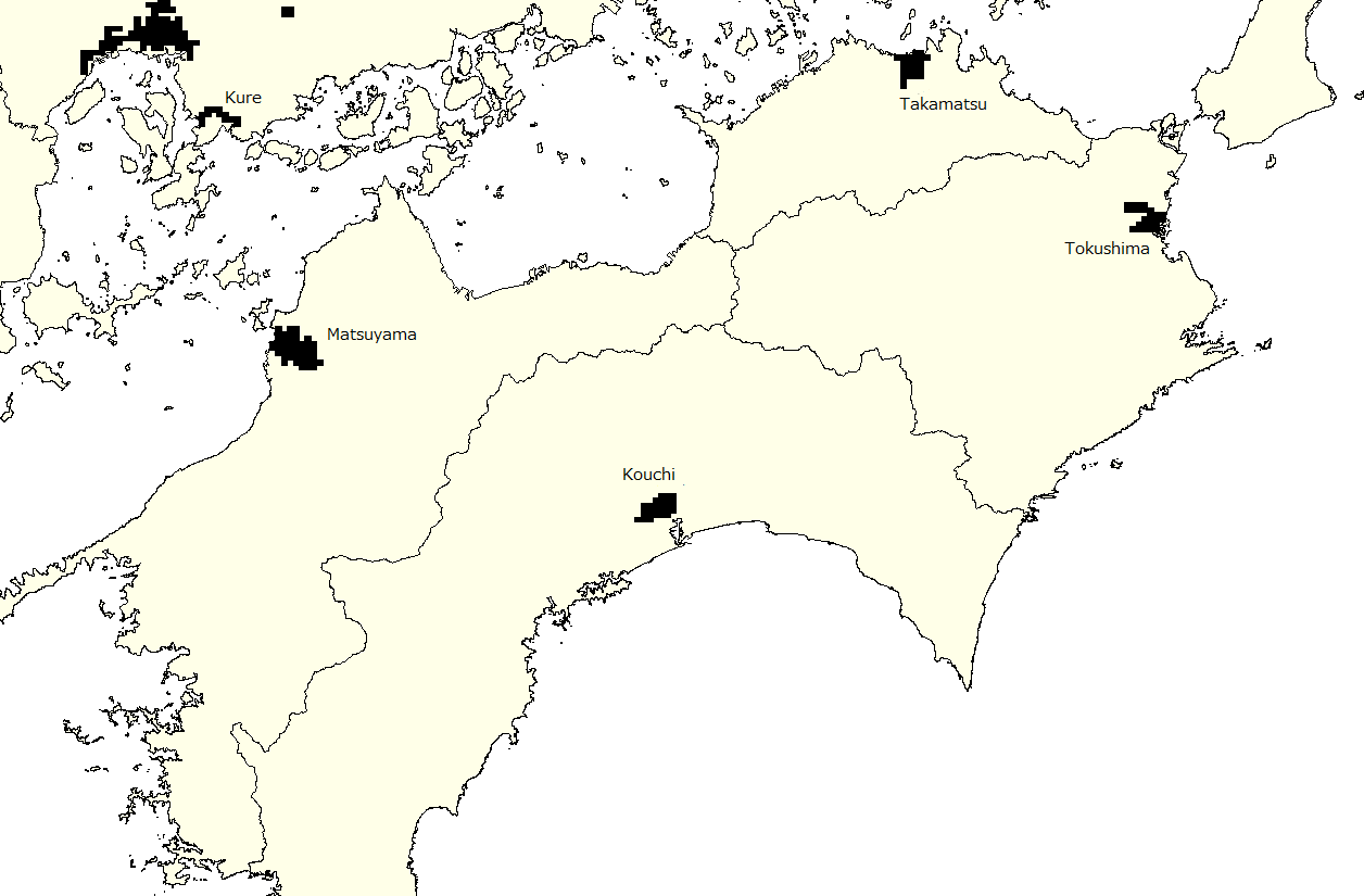
In the Shikoku region, urban areas include Tokushima City in Tokushima
Prefecture, Takamatsu in Kagawa Prefecture, Matsuyama in Ehime Prefecture
and Kochi City in Kochi Prefecture.
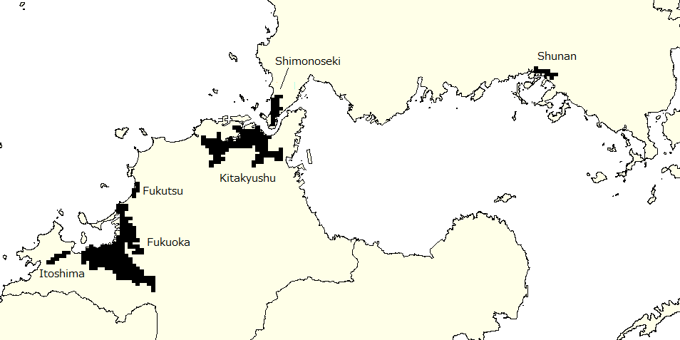
In Yamaguchi Prefecture, Shunan and Shimonoseki can be identified as urban
areas. In Fukuoka Prefecture, Fukutsu, Itoshima, and Kurume are defined
as urban areas around Kitakyushu and Fukuoka cities.
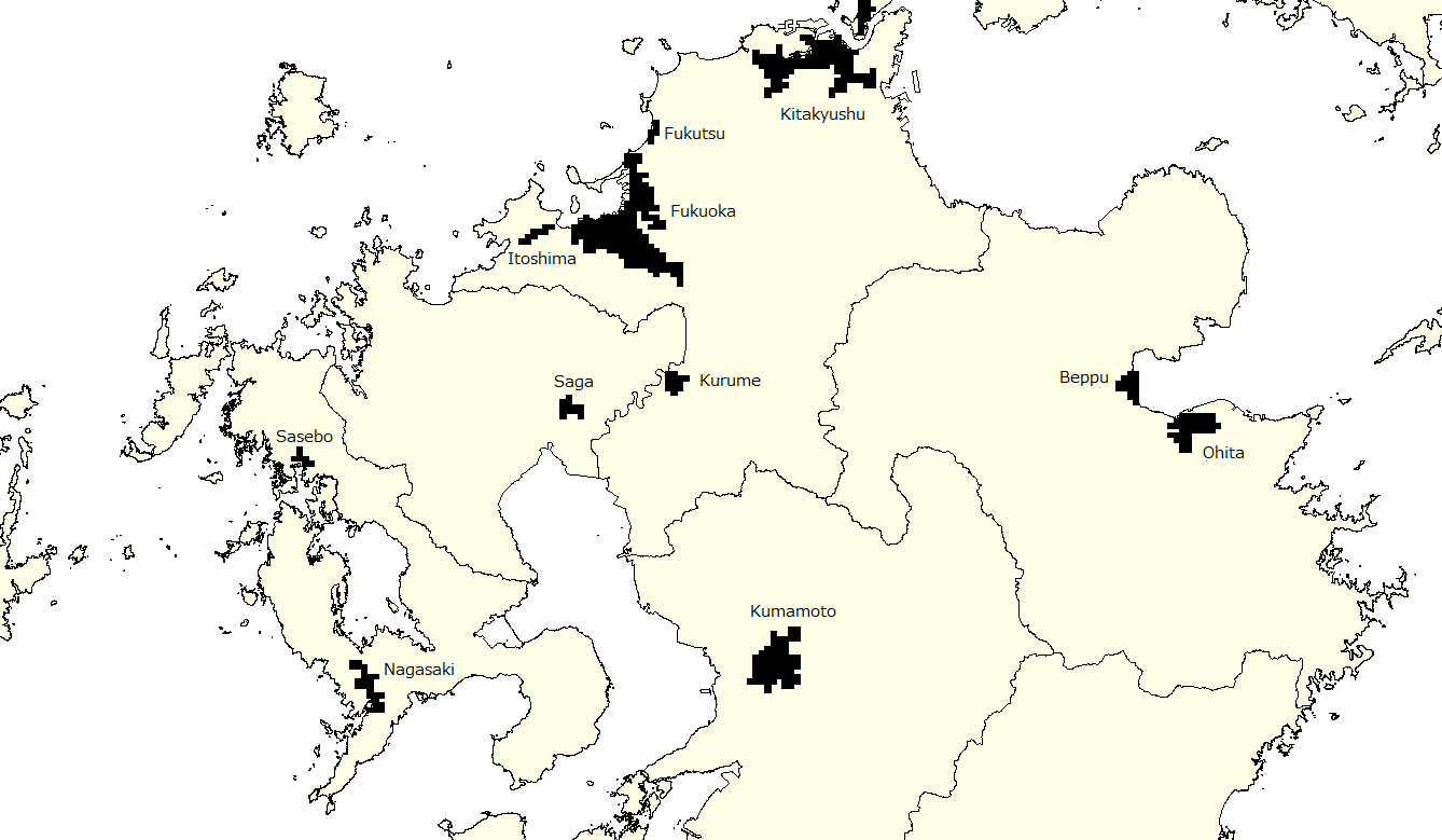
In northern Kyushu, Sasebo, and Nagasaki cities are
urban areas in Nagasaki Prefecture. Saga Prefecture’s capital of Saga can be recognized, as well as Oita City
and Beppu in Oita Prefecture, and Kumamoto City in Kumamoto Prefecture.
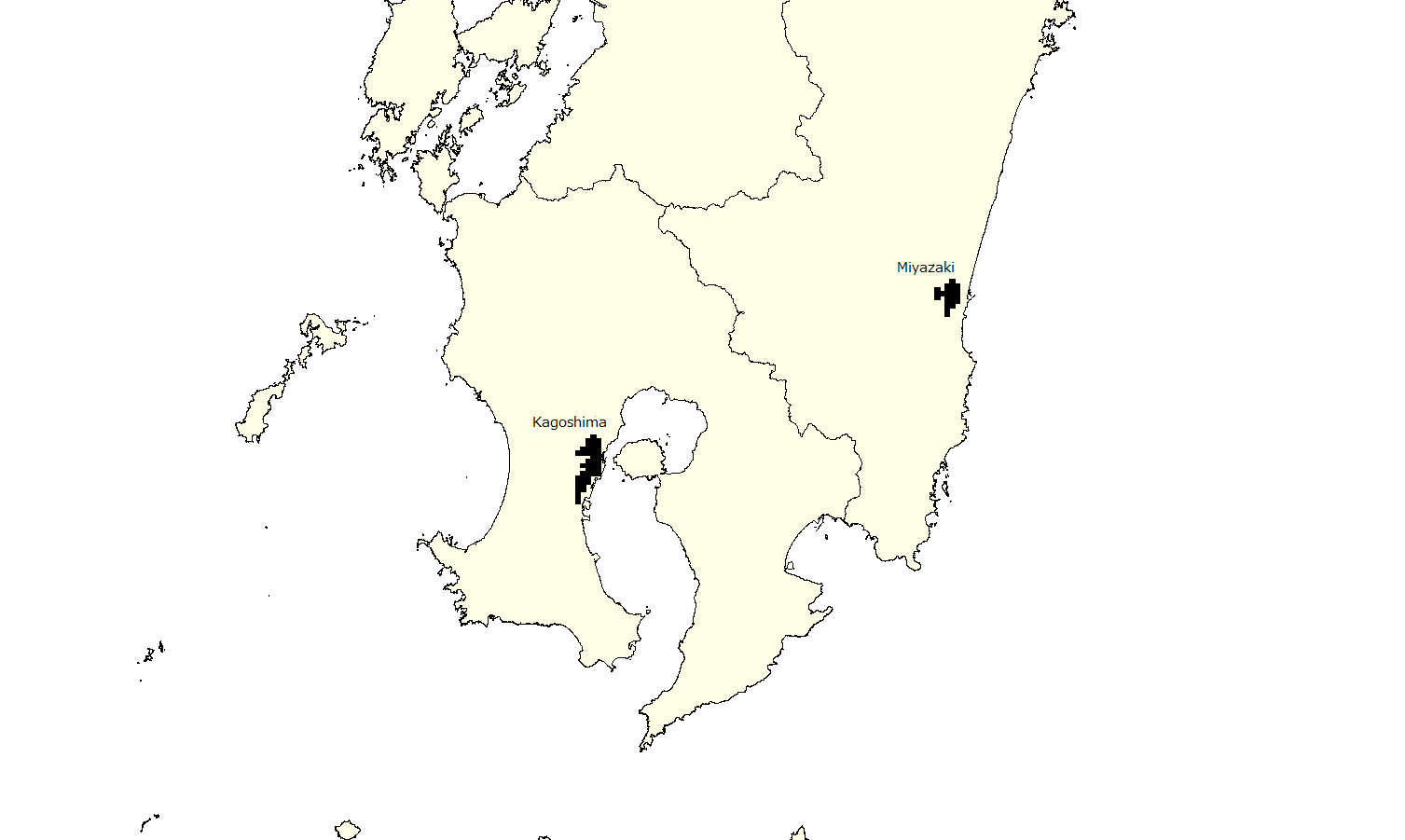
In southern Kyushu, the city of Miyazaki in Miyazaki Prefecture and the
city of Kagoshima in Kagoshima Prefecture are defined as urban areas.
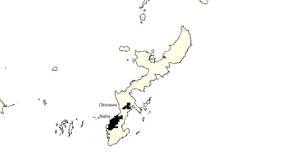
Finally, in Okinawa Prefecture, Okinawa City and Naha can be identified.
As noted above, a total of 118 cities appeared as UAs. The number of UAs for each area is as follows:
Hokkaido (7); Tohoku (11); Kanto (30); Koshinetsu (5); Chubu/Tokai (16); Hokuriku (4); Kansai (15); Shikoku (4); Chugoku (11); Kyushu (13); Okinawa (2)
A large concentration of UAs within the Pacific coastal belt area was expected; however, it is intriguing that the number of UAs is greater in a part of the Chubu/Tokai subregion than in the part located within the Kansai region.
Table 3 shows the 2010 population of each of the 118 cities detected here. The population size of urban areas that is defined based on population density of ≥5,000 people per km2 is projected at approximately 24 million in Tokyo, including in Yokohama and in Kawasaki, 8.8 million in Osaka/Kobe, 2.3 million in Nagoya, around 1.6 million in Sapporo and in Fukuoka, 1.45 million in Kyoto, 0.89 million in Hiroshima, 0.8 million in Chiba, 0.67 million in Sendai and in Kitakyushu, and 0.5 million in Naha, as well as 50,000 to 0.3 million in other cities.
Table 3. Population of the 118 identified urban areas in 2010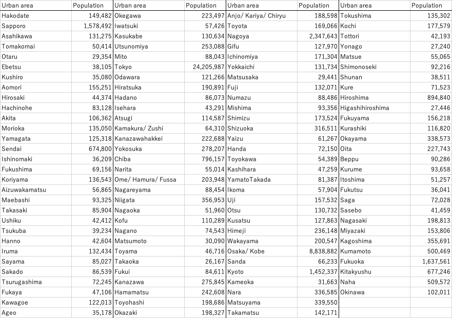
| Access to mdbUA2010 (Nationwide Version) |
The file for SPSS that we created for “mdbUA2010 Japan” is here available.
This file identifies each urban area by grid square code and its population size as a SPSS syntax file. For usage, please refer to the correspondent pages on this website (sorry, Japanese page only).
※As in previous cases, Ryota Kanazawa provided instrumental assistance in the creation of this syntax file.
![]()
ConTAct us AT
Prof. Kazushi Tamano
2-11 Wakaba Mihama-ku
Chiba-City, Chiba, Japan 261-8586
(The Open University of Japan)
tamano@k.email.ne.jp