PROJECT I
| What is the Issue? |
It is a basic requirement for urban research to define the geographical extent of so-called urban area.
In the United States, urban area is defined by population density. Urbanized areas (UAs) are defined as places with more than 50,000 people. And places of at least 2,500 and less than 50,000 are classified as Urban Clusters (UCs).
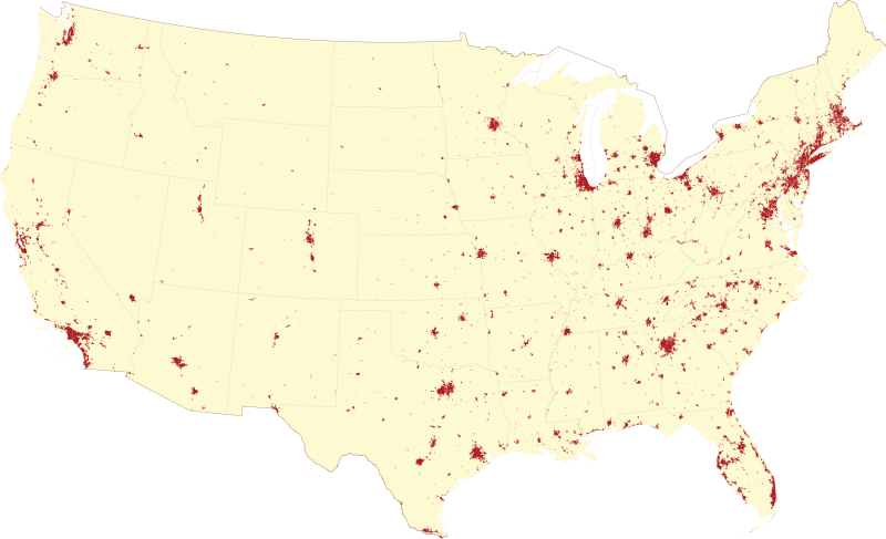
An enlargeable map showing urban areas and urban clusters
of the contiguous United States, based on the 2000 census
(from Wikipedia 'United States urban area' )

In Britain, Urban Area is defined by population density of the areas based
on Ordnance Survey's district units. According to Ordnance Survey, an urban
area is at least 20ha large and houses more than 1,500 residents. The left
map of England shows the 56 Primary Urban Areas (from Office of the Deputy
Prime Minister. (2006) State of the Einglish Cities Vol. 1 pp.24 ).
In Japan, it is defined as an area with a population density of more than
4,000 people, referred to as a DID (Densely Inhabited District). This definition
creates issues however, as it obscures the geographical extension of cities
by allowing its boundary to extend far wider than it should. Moreover,
because an urban area's coverage defined by national census alters each
time, it hinders smooth time-series comparison analysis.
In the aim to solve this issue, here at Tamano lab, "mdbUA: meshed
data based Urban Area" has been developed. This is a unit that defines
the boundary-lines of urbanized areas.
![]()
ConTAct us AT
Prof. Kazushi Tamano
2-11 Wakaba Mihama-ku
Chiba-City, Chiba, Japan 261-8586
(The Open University of Japan)
tamano@k.email.ne.jp