| 天気概況 |
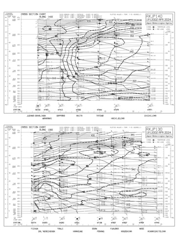
エマグラム |
週間予報 |
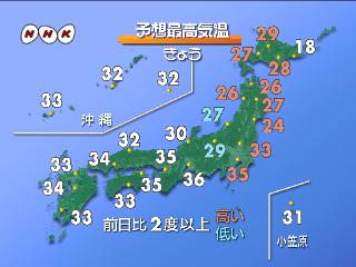
| NHK News(天気) |
| |
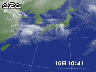
| 衛星画像 |
実況天気図 |
予想天気図 |
 |
 |
 |
|
|
|
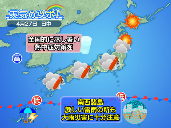
| 本日の天気のツボ(朝) |
雲、雷発生予想 |
高知大学提供 |
 |
 |

|
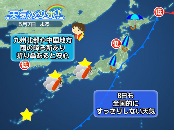
| 本日の天気のツボ(夜) |
|
|
|
|
|
|
|
|
空港雨量情報
降水確率

降水量
最新の気象観測値
(気象庁様より) |
レーダー画像1(Tenki.jp様より)

レーダー画像2
短期間降水予報

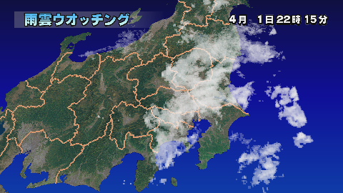
雨雲ウォッチング
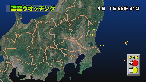
雷雲ウォッチング
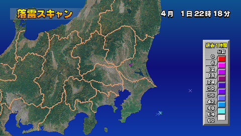
落雷スキャン
 |
レーダーアメダス1

レーダーアメダス2
 
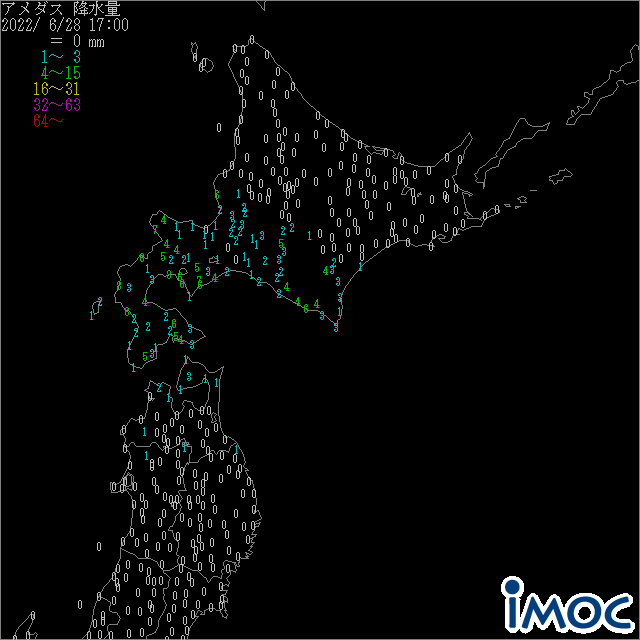
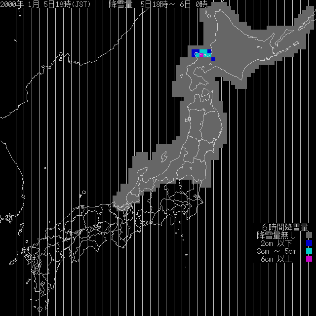
アメダス
|
警報

|
予報ガイダンス
|
アニメーション

|
今日の天気

|
明日の天気

|
予想気温
|
|
GMS海面温度

|
台風情報

|
雲画像による風解析
|
雲画像時系列
 |
|
本日の月齢
月齢カレンダー
プラネタリウム |
世界の天気

|
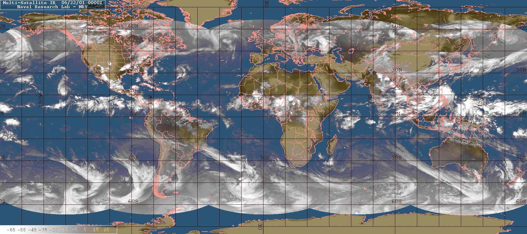
World-wide Montage Vis

World-wide IR

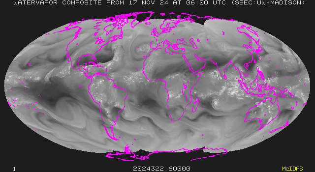
World-wide water vapor
|
IR画面にOverlayした画像
|
雲頂高度
|
雲と上層風
|
|
|
|
ストレッチ画像
|
|
|
|
|
|
| 韓国 |
|
|
| Satellite Images |
Short Range Forecast |
Mid Range Forecast |
| Surface Weather Chart |
Analysis Auxiliary ChartA
Analysis Auxiliary ChartB |
Forecast Auxiliary Chart
|
|
|
|
| Hong Kong |
|
|
Surface Weather Maps
|
Upper-level Weather Maps
|
|
| Radar Image |
|
|
|
|
|
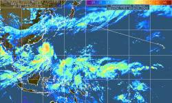
| Singapore |
|
|
| Radar Plot |
|
|
|
|
|
| アメリカ |
|
|
|
|
|
|
|
|
Doppler Radar Image
 |

Intellicast |
| Overlay Display |
|
|
| USA国内RVR |

Doppler RADAR
|
天気図
| 現況 |
12時間後 |
 |
 |
|
|
| 24時間後 |
36時間後 |
 |
 |
|
|
| 48時間後 |
|
 |
|
|
衛星画像

RADAR |
GOES WEST
- Western United States
- Full Hemisphere
- Zoom
|
GOES EAST
- Eastern United States
- Full Hemisphere
- Zoom
|
Surface Prognostication
Sea Lvl Pressure
Min. Temp
Max. Temp
Precip Probability
|
| Radar summary RCM |
Temperature Map |
Satelite Image of the US |
| Atlantic Infrared Enhanced |
Latest infrared |
U.S. Cloud Cover
|
| Ultraviolet Index |
Lows So Far Today |
Highs So Far Today |
| USA Visible satelite West |
USA Visible satelite East |
USA Airport Conditions |
| West Coast of US; Infrared |
East Coast of US; Infrared |
Visibility |
| Eastern Pacific satelite |
Pacific satelite Image |
Surface Pressure/Wind Analysis |
| N.E. Pacific Tropical Cyclones |
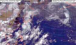
N.W. Pacific Tropical Cyclones |
U.S. Flight Delays |
| Hawaii Infrared satelite |
|
|
| Alaska Surface chart |
Alaska: Turbulence |
Alaska: Areas of Icing |
| Alaska Thermal IR |
Alaska Visible |
Alaska Water Vapor |

Thunder Storm |
CANADA Lightning
 |
North AMERICA Jet Stream

|
| North American Composite
|
Eastern Canada
|
Eastern North America
|
| Eastern USA
|
North Atlantic
|
North and South America
|
| Western Canada
|
Western North America
|
North Pacific
|
| Pacific and North America
|
|
|
| Northern Canada and Arctic
|
Canadian Arctic
|
Baffin Island / Qikiqtaaluk
|
| Yukon
|
Northern Nunavut
|
Northwest Territories
|
|
|
|
| Aust/New Zeal |
|
|
Synoptic Chart
 |
Prognostic Chart
 |
Latest Mean Sea Level Pressure
Weather chart (from Uni Koln) |
|
|
|
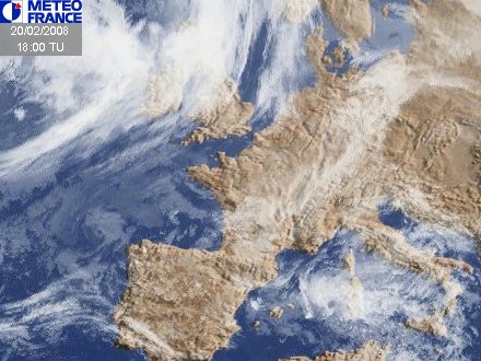
| ヨーロッパ |
|
|
Satelite View
 |
Visual Forecast
 |
Storm map
 |
|
|
Europe Visible
 |
Tomorrow's Forecast
|
| 10-Day Temperature Outlook |
European Surface Temperatures |
Europe Infrared satelite |
| Rainfall Chart |
Visible Satelite |
Surface Analysis |
|
|

|
Lightning Strikes

|
|
|
3 day surface pressure animation |
|
|
|
|
 |


