|
DX Pedition Jul.2024
NoneBeam ANT,Power100Watts
80/40m 6mH DP, 20/17/15m 5mH VDP, 40/30/20/15/10m Vertical 0mHとPWR100W(IC-7300).
CWとSSBはどこでコールするかが重要なポイントです。
DXPedi局が何処をワッチしているかが分かれば交信の確率は上がります。
今まではdxescapeへのレポートを参考にするか根拠もなくコールしていましたがローカルDXerの
アドバイスを受けてTRXの操作方法などを試行錯誤しているところです。
If I can find the RX Freq. of DxPedi STN. I will be able to get his reply very easily.
so I have been learning the best way to get DXPedi's reply. |
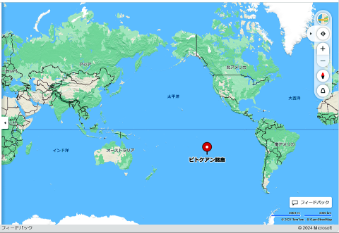
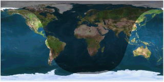
Pitcairn DXpedition 2024-- VP6WR -- Sep.2024
|
画像をクリックすれば拡大画像がみれます
Click on the image to see an enlarged image
出典(Reference):OpenStreetMap
Copyright 2024 Microsoft
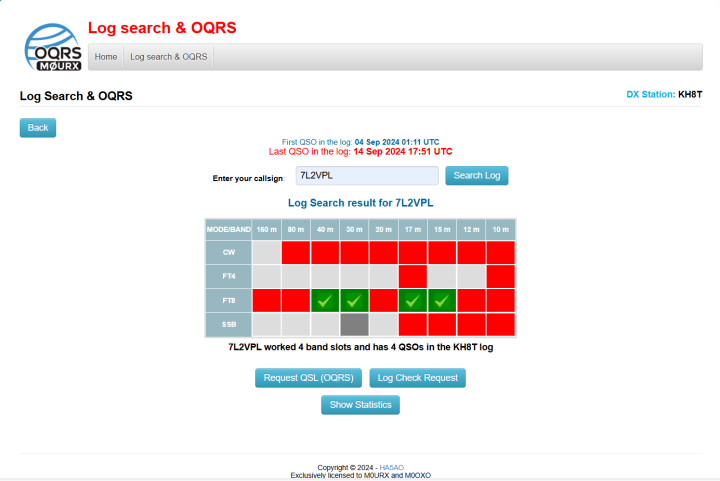
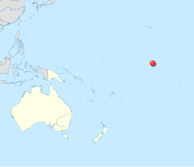
American Samoa 2024 DXpeditions -- KH8T -- Sep.2024
|
画像をクリックすれば拡大画像がみれます
Click on the image to see an enlarged image
| |
.svg.png)
出典(Reference):WikiPedia
TUBS, CC BY-SA 3.0
<https://creativecommons.org/licenses/by-sa/3.0>,
via Wikimedia Commons
https://upload.wikimedia.org/wikipedia/
commons/9/99/American_Samoa_on_the_globe
_%28Polynesia_centered%29.svg |
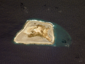
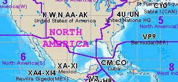
St.Paul Island DXpeditions --- CY9C --- Aug.2024
|
CY9Cの信号は弱くノンビームでは非常に困難でした
It was very hard to contact with CY9C for me.
|
画像をクリックすれば拡大画像がみれます
Click on the image to see an enlarged image
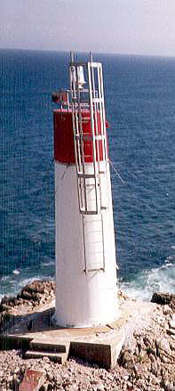
St. Paul Island (French: Île Saint-Paul) is a uninhabited island located approximately 24 km (15 mi) northeast of Cape North on Cape Breton Island and 71 km (44 mi) southwest of Cape Ray on Newfoundland; it is along the boundary between the Gulf of St. Lawrence and the Cabot Strait.
出典(Reference):WikiPedia
Aarchiba, Public domain, via Wikimedia Commons
https://commons.wikimedia.org/wiki/File:Spraycan-lighthouse.jpg
|
.png)
出典(Reference):WikiPedia
Klaus M., CC BY-SA 2.5
<https://creativecommons.org/licenses/by-sa/2.5>, via Wikimedia
Commons
https://commons.wikimedia.org/wiki/File:Saint_Paul_Island_(Nova_Scotia).png |
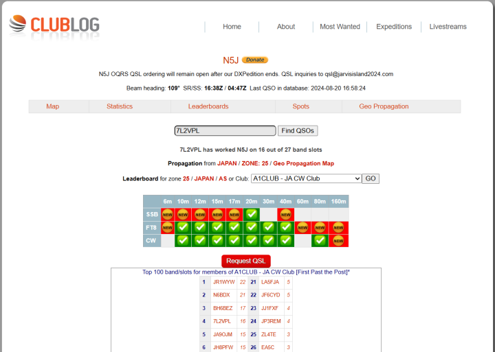
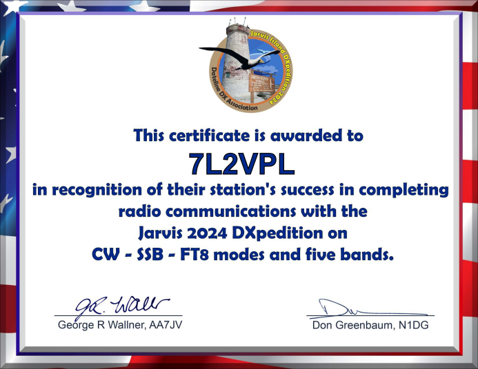
Jarvis Island DXpeditions --- N5J --- Aug.2024
|
画像をクリックすれば拡大画像がみれます
Click on the image to see an enlarged image
2024/Aug.22
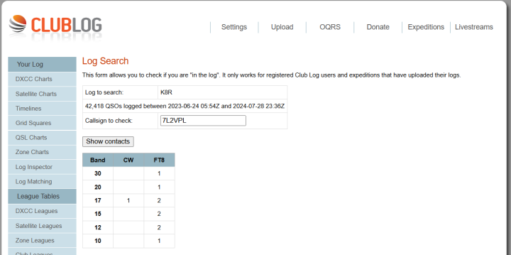
AMERICAN SAMOA USA DXpeditions --- K8R --- Jul.2024
|
画像をクリックすれば拡大画像がみれます
Click on the image to see an enlarged image
2024/Aug.22
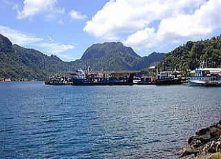
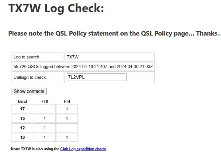
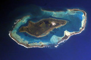
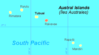
Raivavae, Austral Islands DXpeditions --- TX7W --- Apr.2024
|
画像をクリックすれば拡大画像がみれます
Click on the image to see an enlarged image
2024/Aug.22
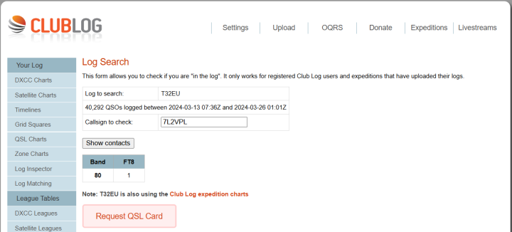
East Kiribati DXpeditions --- T32EU --- Mar.2024
|
画像をクリックすれば拡大画像がみれます
Click on the image to see an enlarged image
2024/Aug.22
出典(Reference):QRZ.com
DX Atlas by QRZ Ham Radio
CLIPPERTON ISLAND DXpeditions --- TX5S --- Jan.2024
|
画像をクリックすれば拡大画像がみれます
Click on the image to see an enlarged image
2024/Aug.22
.svg.png)
出典(Reference):WikiPedia
CC BY-SA 3.0 <http://creativecommons.org/licenses/by-sa/3.0/>,
via Wikimedia Commons
File:Carteactuelle.jpg:
Christian Jostof File:Ile de Clipperton (carte-fr).svg:
TrexTranslation to English and derivative work of this file:
Maproom,
|
出典(Reference):WikiPedia
TUBS, CC BY-SA 3.0
<https://creativecommons.org/licenses/by-sa/3.0>,
via Wikimedia Commons
File:https://upload.wikimedia.org/wikipedia/commons
/3/32/Clipperton_Island_in_its_region.svg
|
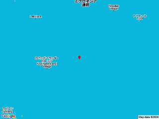
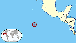
Swains Island DXpeditions --- N8S --- Apr.2007
|
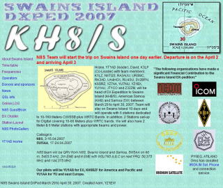 |
Apr.13 2007
I worked with N8S on 17m cw,30m cw
and 40m cw.
|
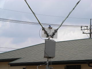
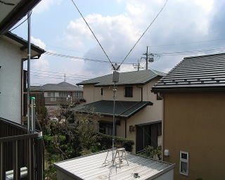
My Rigs are 50 watts out & 6mtrs high delta loop with AH-3 or 7mtrs
high GP
|
|
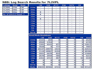
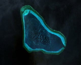
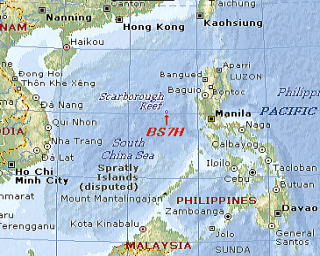
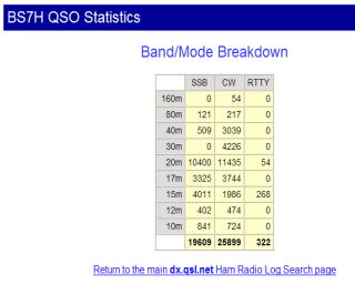
Scarborough Reef DXpeditions ---BS7H --- May. 2007
|
|
|
My Rigs were 50 watts out & 6mtrs high delta loop
with AH-3
|
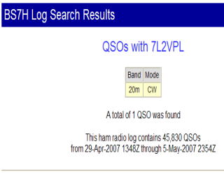
as of May.1st 2007 UTC
I probably worked with BS7H on 20m cw.
|
 |
 |
 INDEXに戻る INDEXに戻る
|
 Top Page
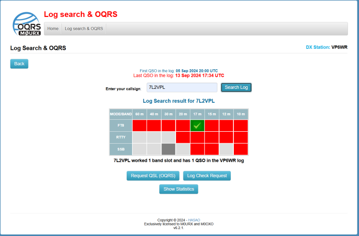

.svg.png)

.svg)